
Across Chicago, the remnants of the city’s rail history can be found just about everywhere. Tracks embedded in asphalt vanish behind chain-link fences, bridges reach into the sky, and overgrown corridors cut quietly through neighborhoods where trains once ran daily. Some of this infrastructure has been abandoned entirely, some still carries the occasional train, and some may have a new life as rail trails. The old tracks trace the outlines of the rail network that once powered the city and connected the rest of the country.
Photos by Ken Carl and Meredith Francis.
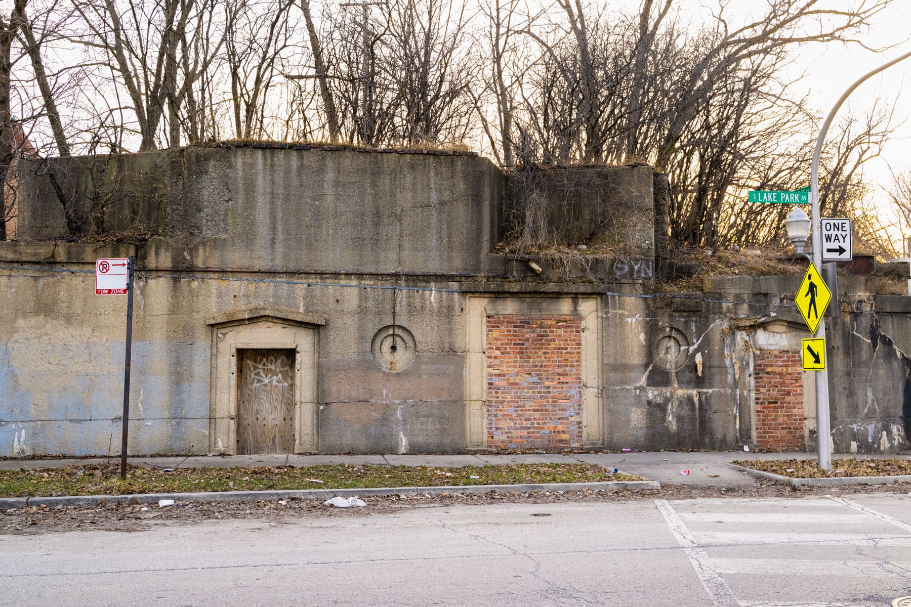
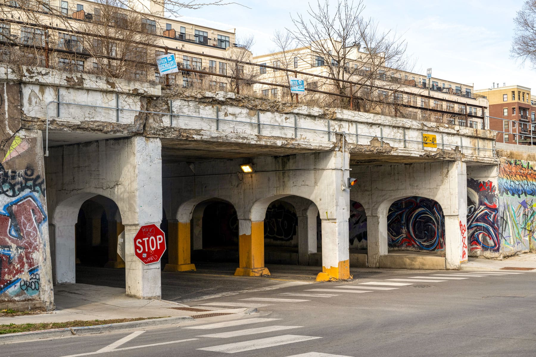
At 41st Street and Lake Park Avenue on Chicago’s South Side, there is the ghost of the old Ellis-Lake Park Station, a stop on the former Kenwood branch ‘L’ line. The Kenwood line, which diverged from the South Side Elevated main line (now part of the Green Line) near Indiana Avenue, first opened in 1907 and stretched for 1.25 miles with six stations. Today, instead of a platform, the embankment has become a kind of urban forest, with decades of overgrowth.
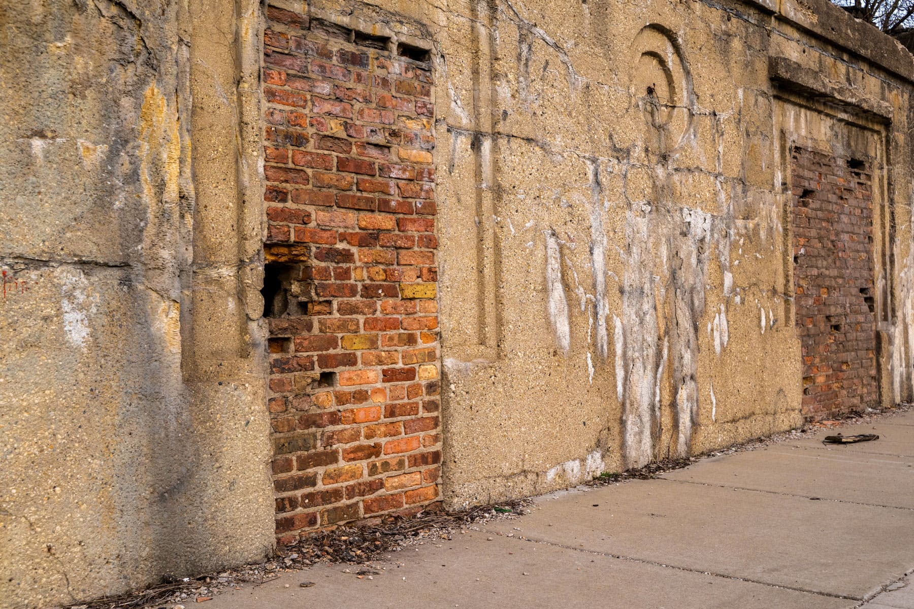
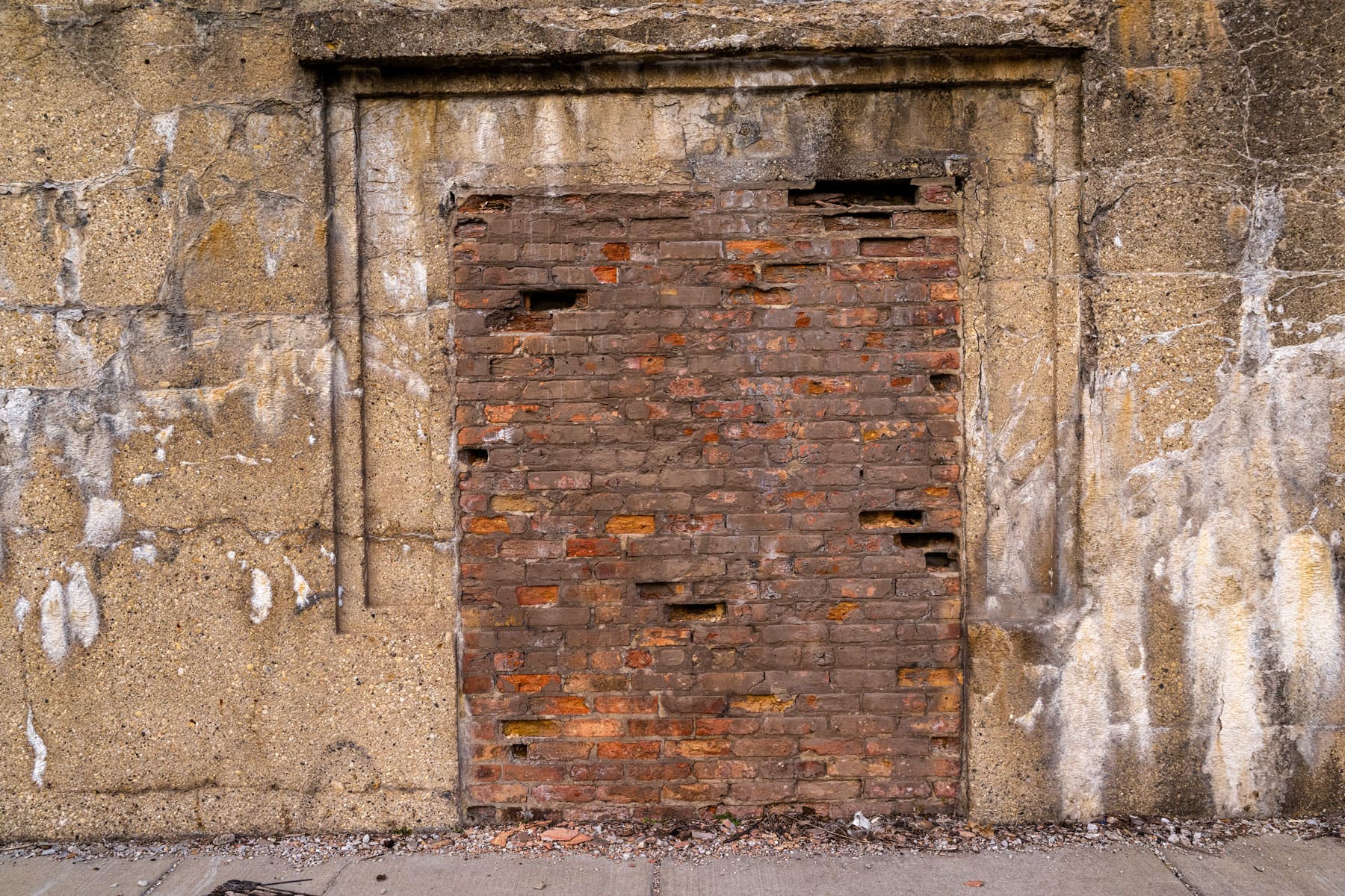
The stations were simple, with three doors built into a concrete embankment. Like the Lake Park entrance, the doors at the Ellis Avenue entrance have long been bricked over.
After years of declining ridership, deteriorating conditions, and mounting financial losses, the Kenwood branch (by then part of the CTA, which formed in 1947) halted service in 1957.
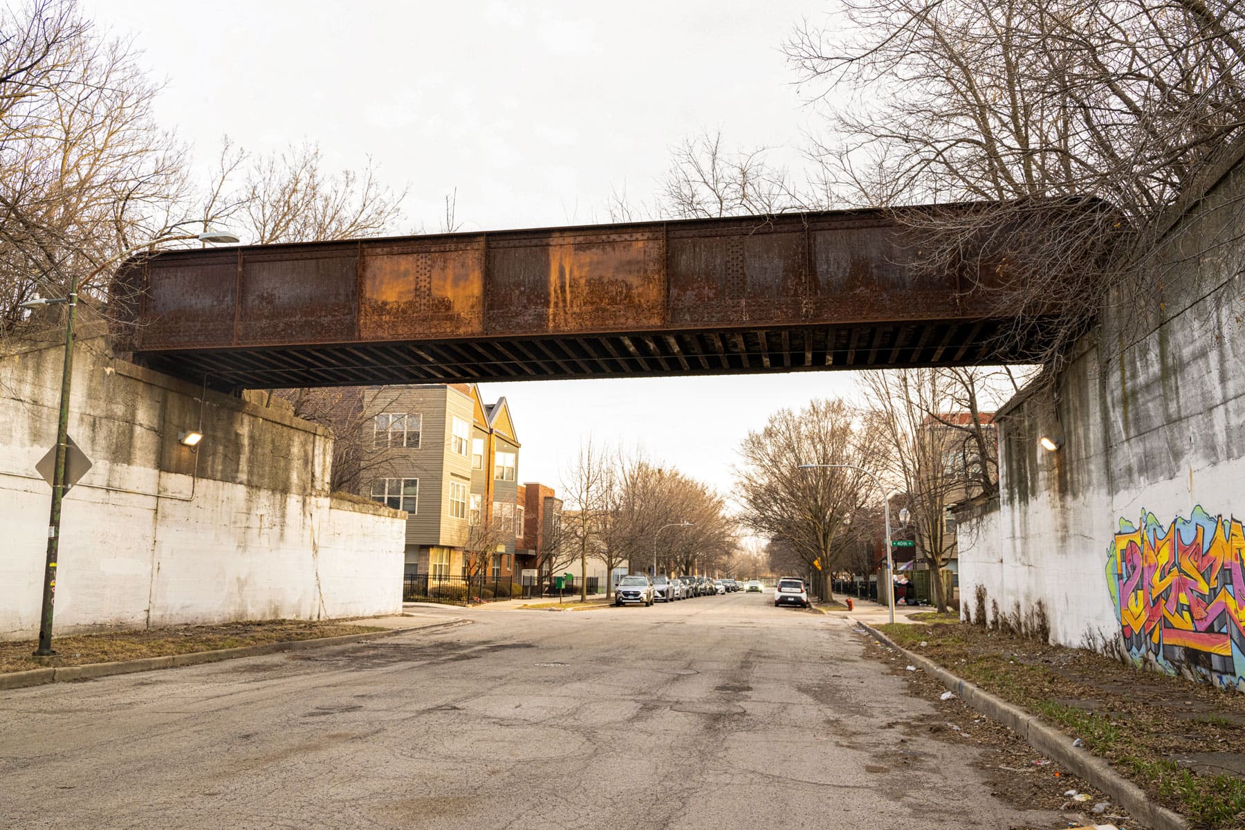
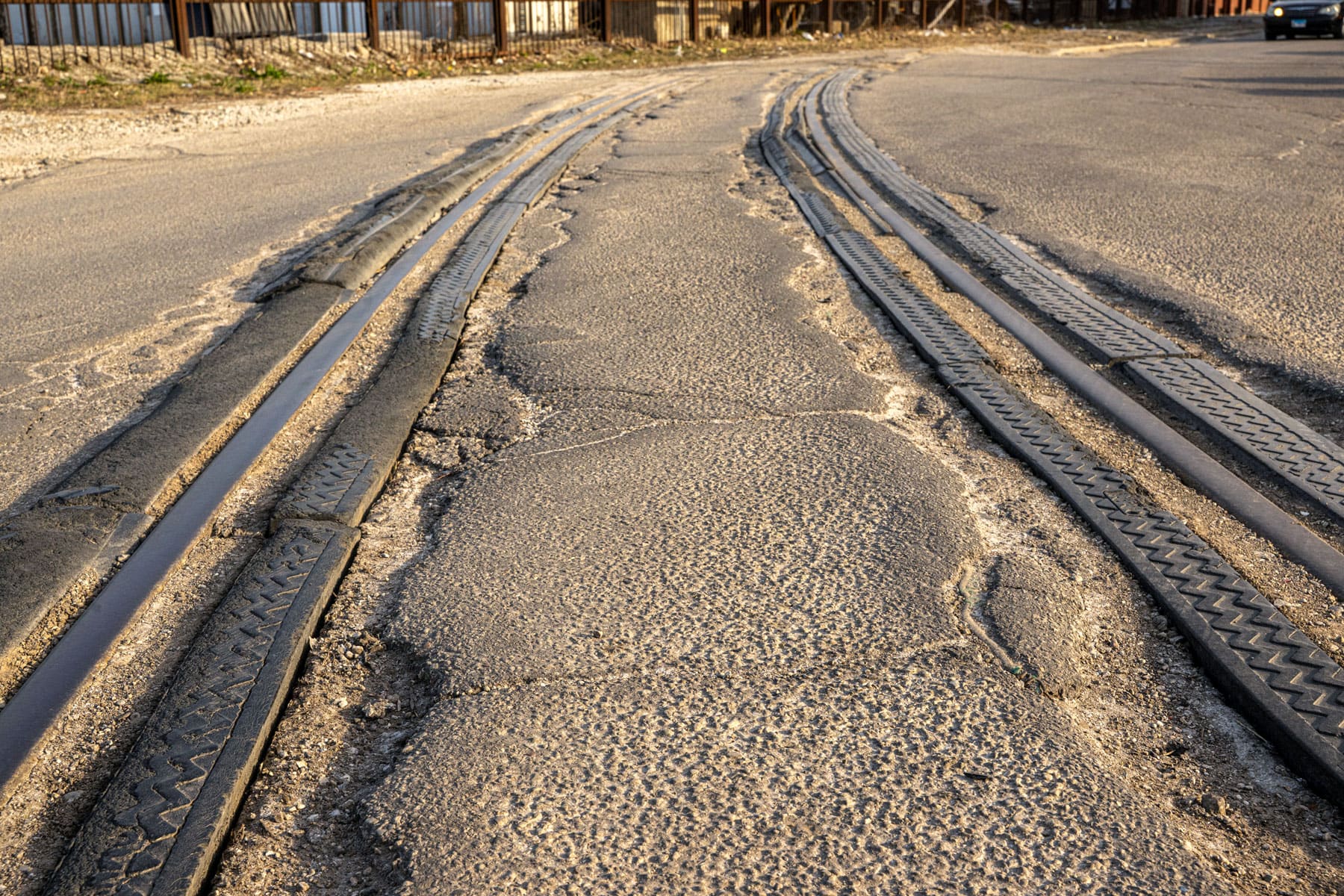
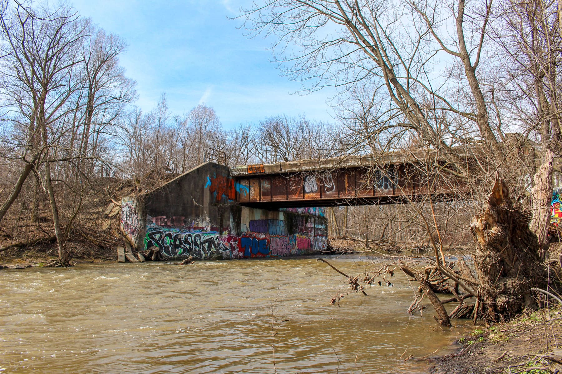
At 40th and Federal streets, an old railroad embankment has become a canvas for graffiti. This corridor dates back to the 1860s, when an east-west rail line along 40th Street was built at grade to transport livestock and goods to and from the Union Stockyards. In the early 20th century, portions of the route were elevated as part of a broader effort to eliminate dangerous street-level crossings.
In the early 1900s, the Chicago Junction Railway elevated sections of track through this area to reduce dangerous rail crossings. The line carried freight trains serving the Union Stockyards and connected with other rail lines, including the north-south Rock Island tracks, which Metra still uses today.
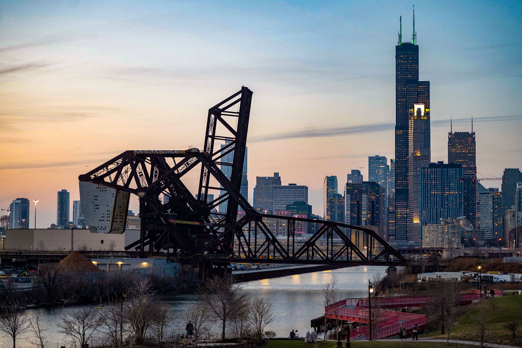
Along the South Branch of the Chicago River near Ping Tom Park in Chinatown, there are two neighboring railroad bridges – one existing in a kind of rail limbo, the other locked permanently skyward. The southernmost bridge is the St. Charles Air Line Bridge (closest to the camera), which has not been in use for several years, though is still able to lift and lower. The northernmost bridge, the Baltimore & Ohio Chicago Terminal Railroad (B&OCT) Bridge, remains upright.
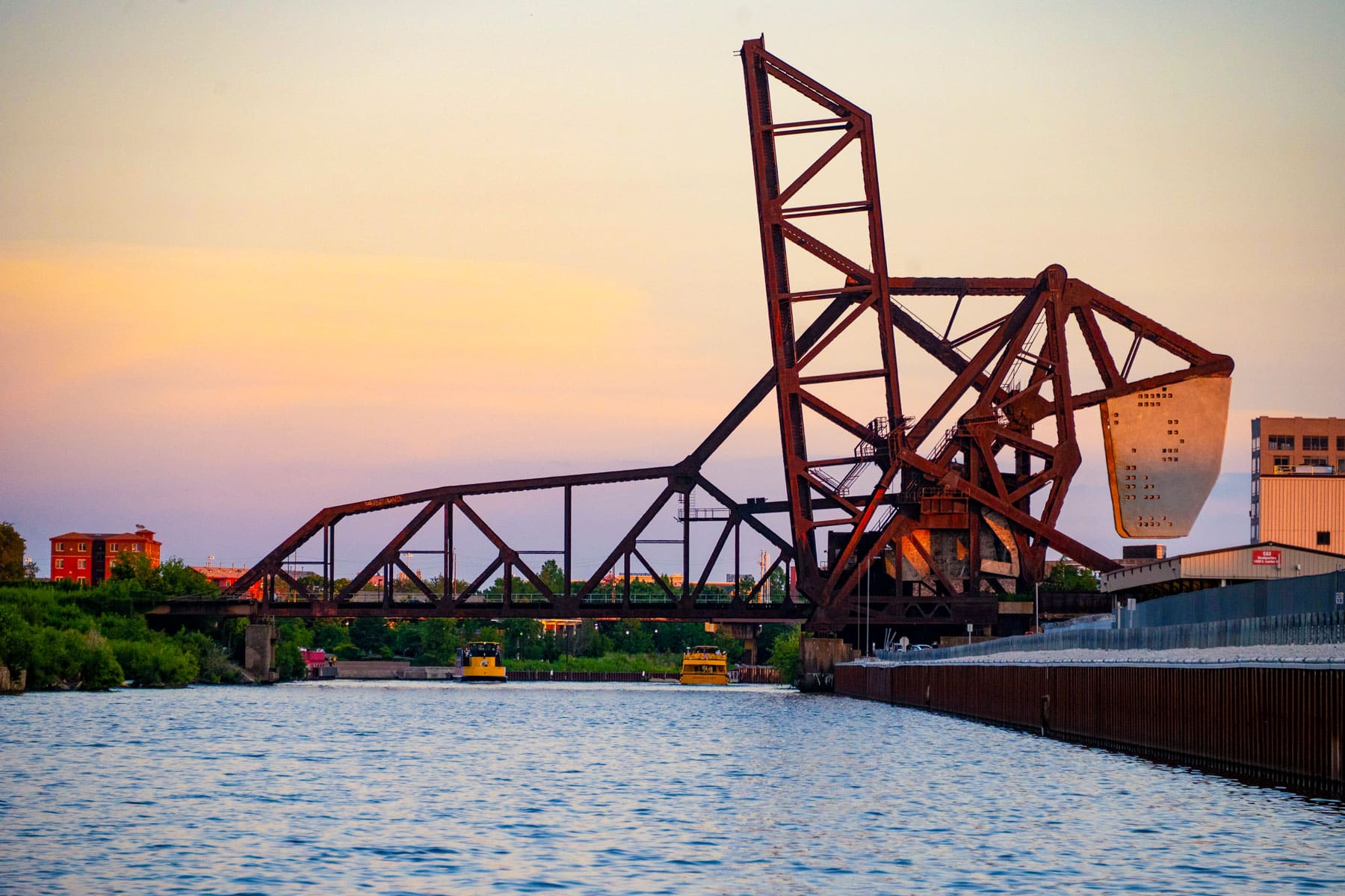
According to the City of Chicago, the St. Charles Air Line Bridge “was the world's longest and heaviest single-leaf bridge when completed” in 1919 by four different railroad companies. It is a single-leaf bascule bridge designed by engineer Joseph Strauss, who was the chief engineer of the Golden Gate Bridge in San Francisco.
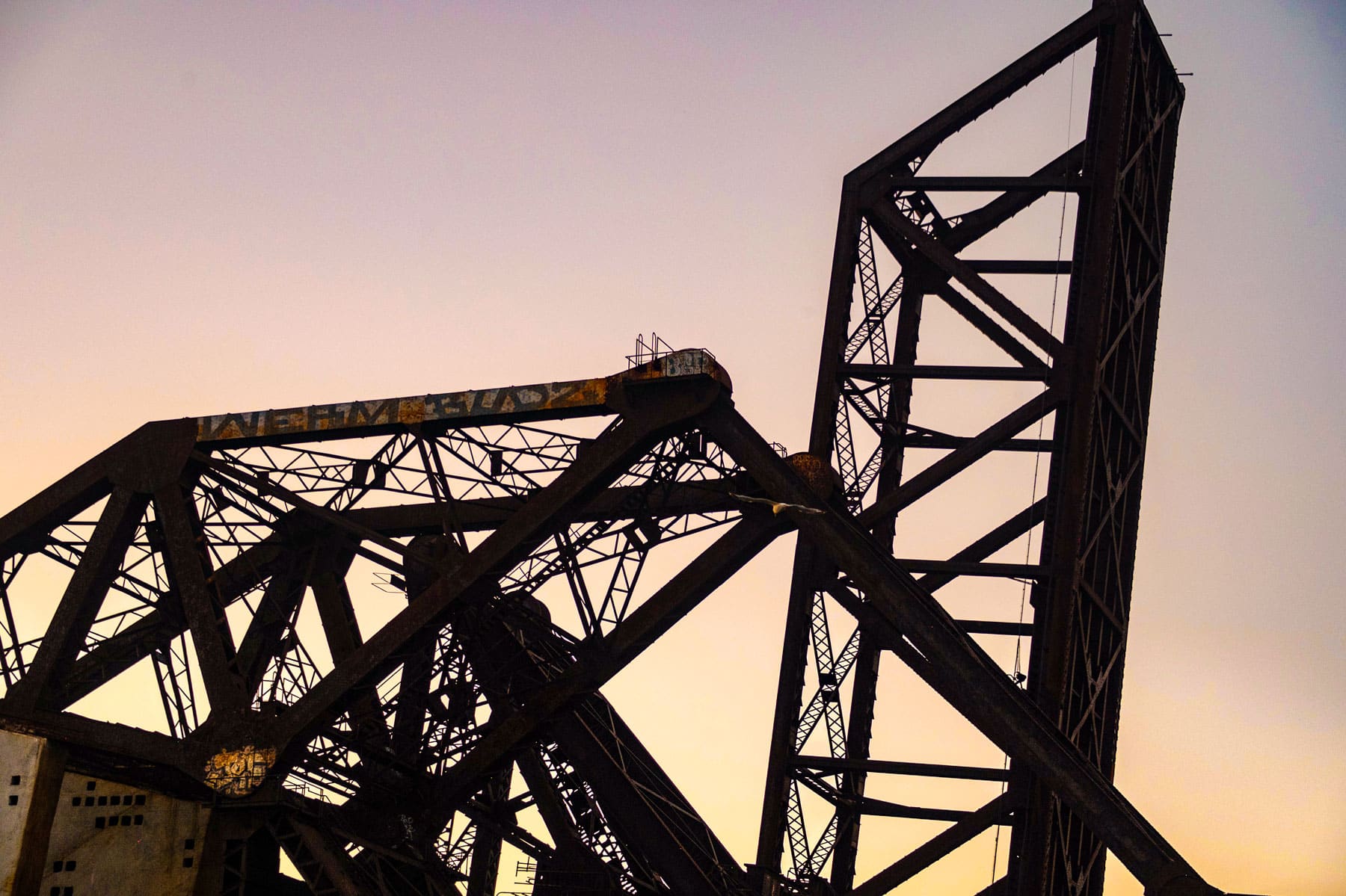
The St. Charles Air Line Bridge was moved and shortened in 1930 when that section of the river was straightened. Today, it’s a city landmark. Its neighbor, the B&OCT Bridge, was built in 1930 and is a trunnion bascule bridge also of Strauss design. It is no longer in use and is kept raised.
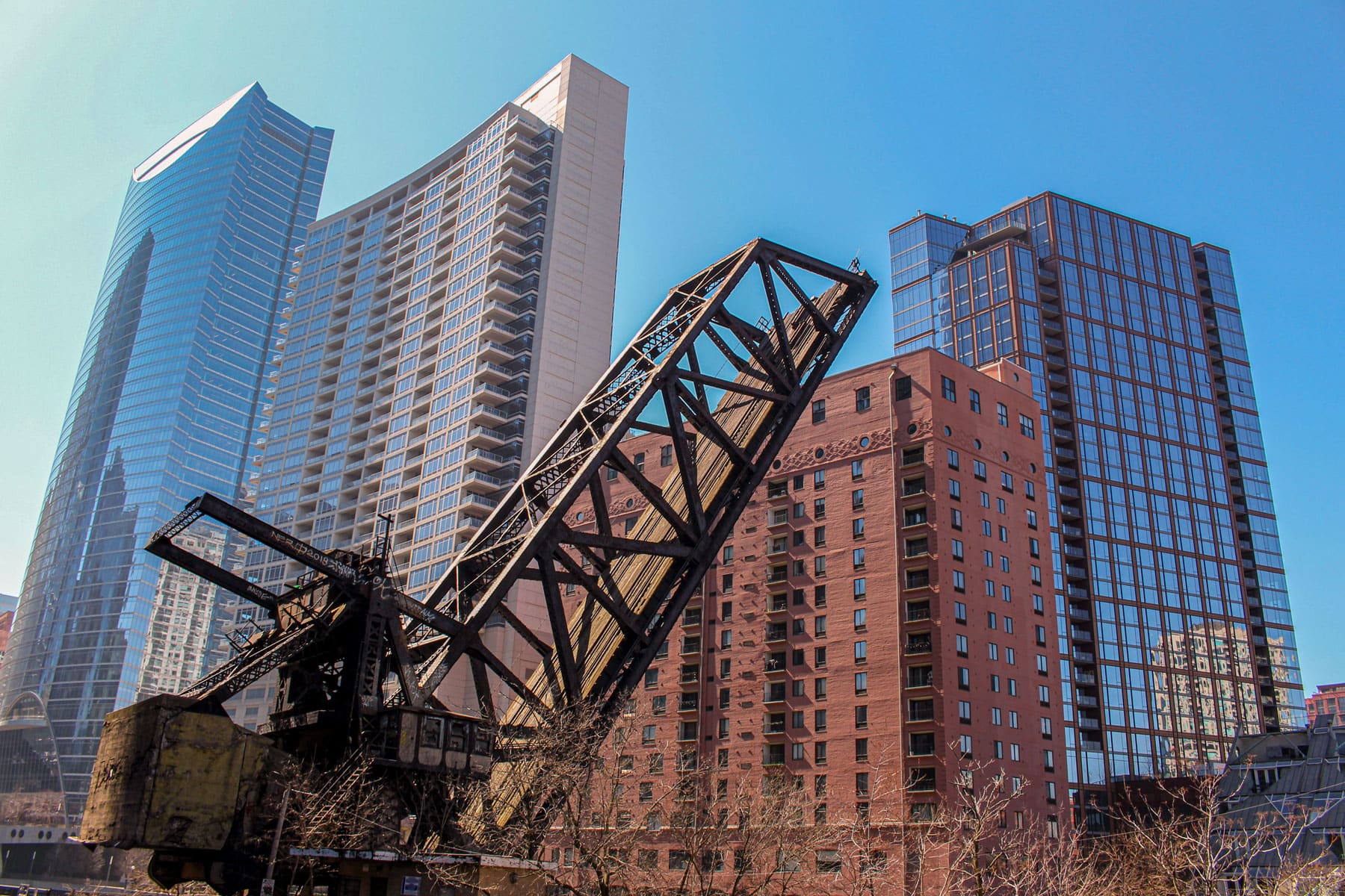
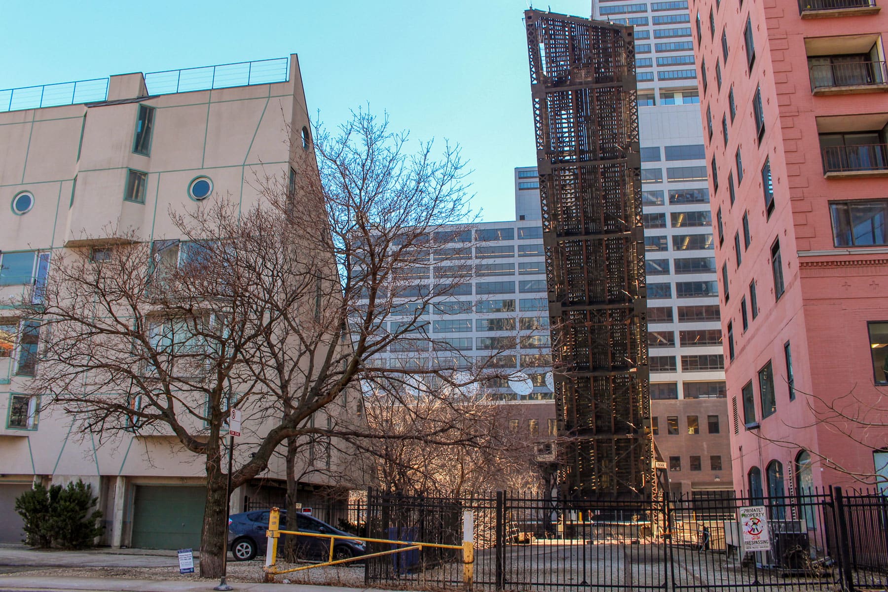
Just south of the Kinzie Street Bridge near Wolf Point, across the river from the tangle of tracks that approach Ogilvie Transportation Center, a single-leaf bascule bridge juts up into the sky. This is the old Chicago and Northwestern Railway Bridge, which opened in 1908.
The bridge, pictured here from west of the river, served the Chicago and Northwestern Railway, which carried both people and goods from Chicago across Illinois, Wisconsin, and Minnesota, linking the city to the wider Midwest during its heyday. There has not been rail traffic across the bridge since 2000.
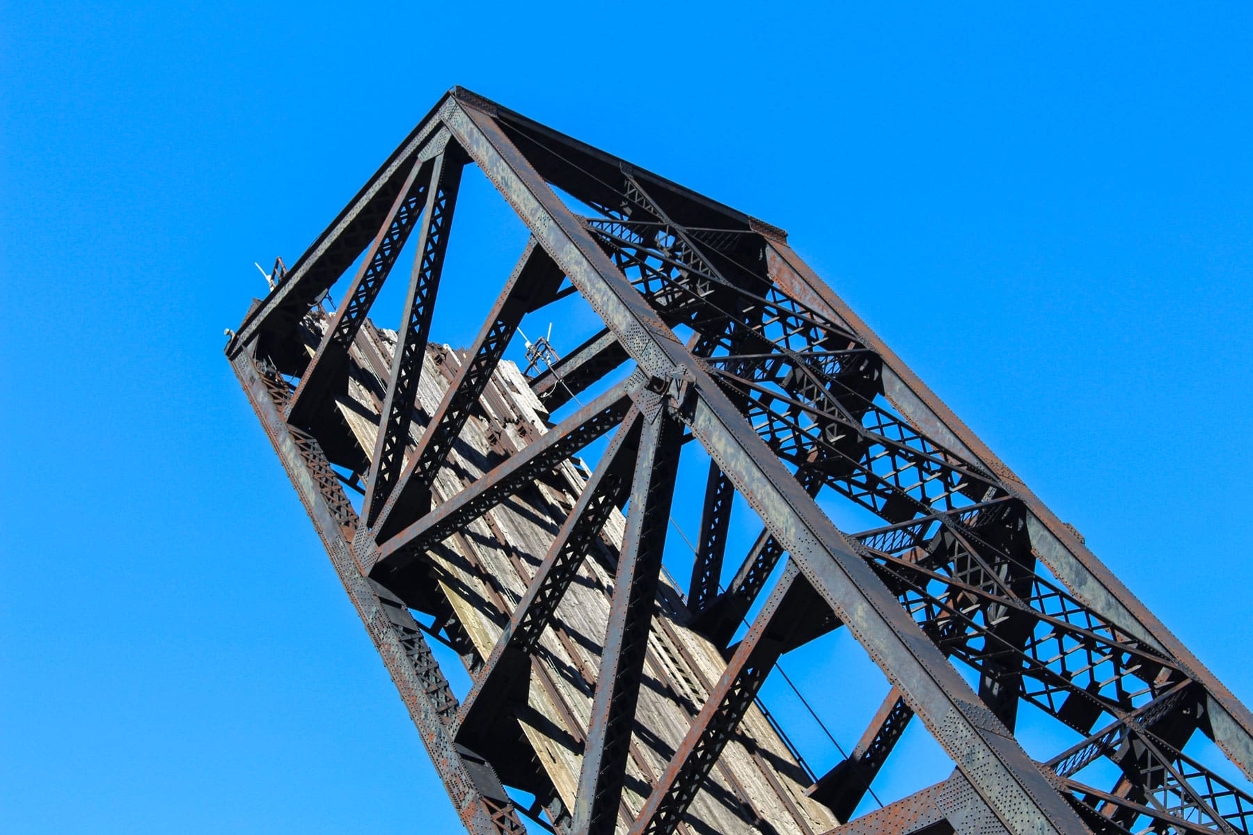
Though it has been lowered occasionally for maintenance, the bridge is almost always locked in the raised position. Like the St. Charles Air Line Bridge, it was named a city landmark.
The connecting tracks to the west of the river also sit unused, though it’s easy to see where they pass beneath the tracks that cross Kinzie Street and diverge north and west out of Ogilvie Transportation Center.
The Cherry Avenue Bridge, which connects Goose Island with North Avenue, was built in 1902 by the Chicago, Milwaukee & St. Paul Railway. It is a “rare asymmetrical ‘bobtail’ swing span bridge,” according to the City of Chicago, built for trains to access businesses on the industrial, manmade island. Though it is locked in place now, it used to swing horizontally over the river to allow boats to pass.
In 2009, the city refurbished the bridge to make it more friendly to pedestrians and cyclists, even though the tracks were still occasionally used for freight trains, per Streetsblog Chicago. The city removed the tracks crossing North Avenue in 2020.
The tracks that once crossed North Avenue from the Cherry Avenue Bridge go behind a stretch of businesses and are still visible on Kingsbury Street.
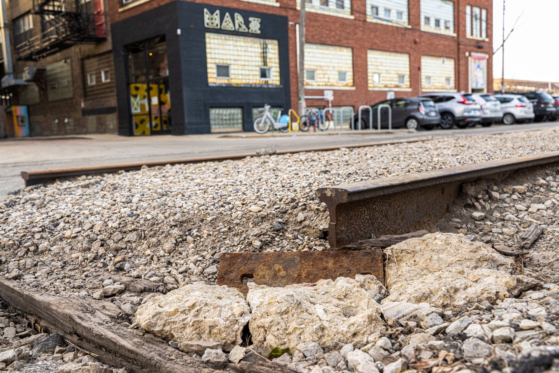
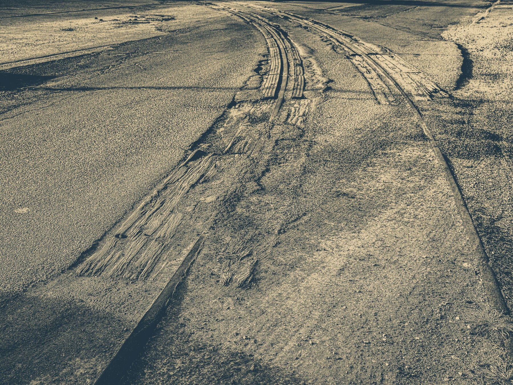
As former industrial areas of the city have been repurposed, the remnants of tracks are still prominent on some Chicago streets, like here outside Marz Brewing in Bridgeport.
These were once part of tracks that served the various factories around the Union Stockyards.
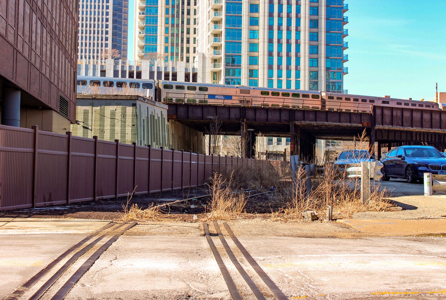
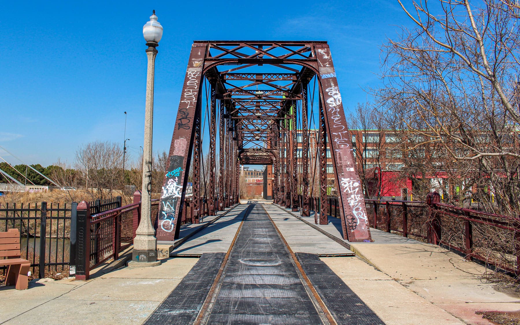
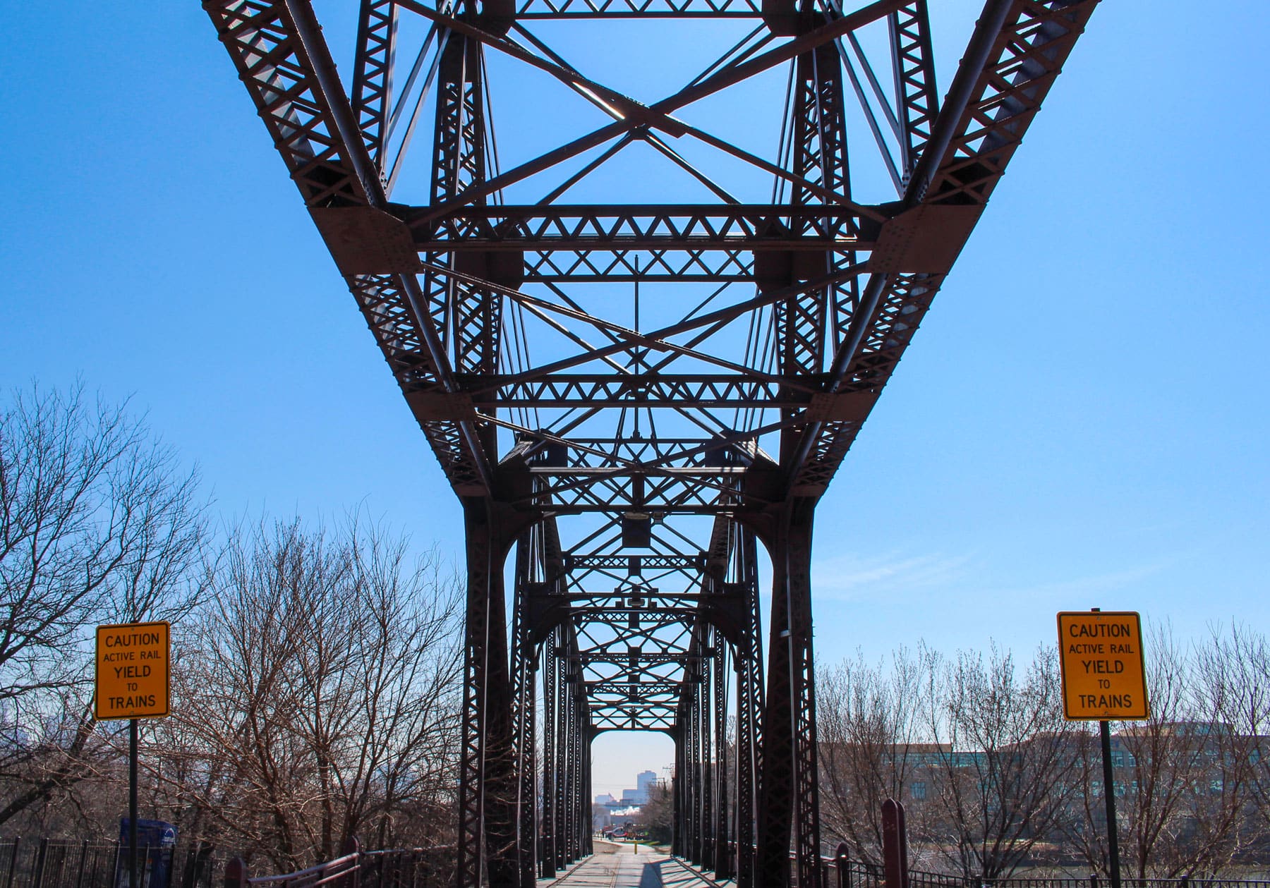
While the ghosts of some tracks disappear behind fences and under asphalt, there are plans to transform other abandoned infrastructure into walking and biking trails, part of a decades-long rails-to-trails movement. A corridor starting near 16th Street and Morgan Street in Pilsen traces a former Burlington Northern Santa Fe (BNSF) spur and may be turned into El Paseo trail. The tracks on this overpass, which still carries freight, Metra, and some Amtrak traffic over a multi-track corridor into Union Station, used to connect to that former spur.
Plans are still being developed for the proposed trail, but as with other converted rail trails (like the 606), community members have expressed concern about the potential for gentrification.
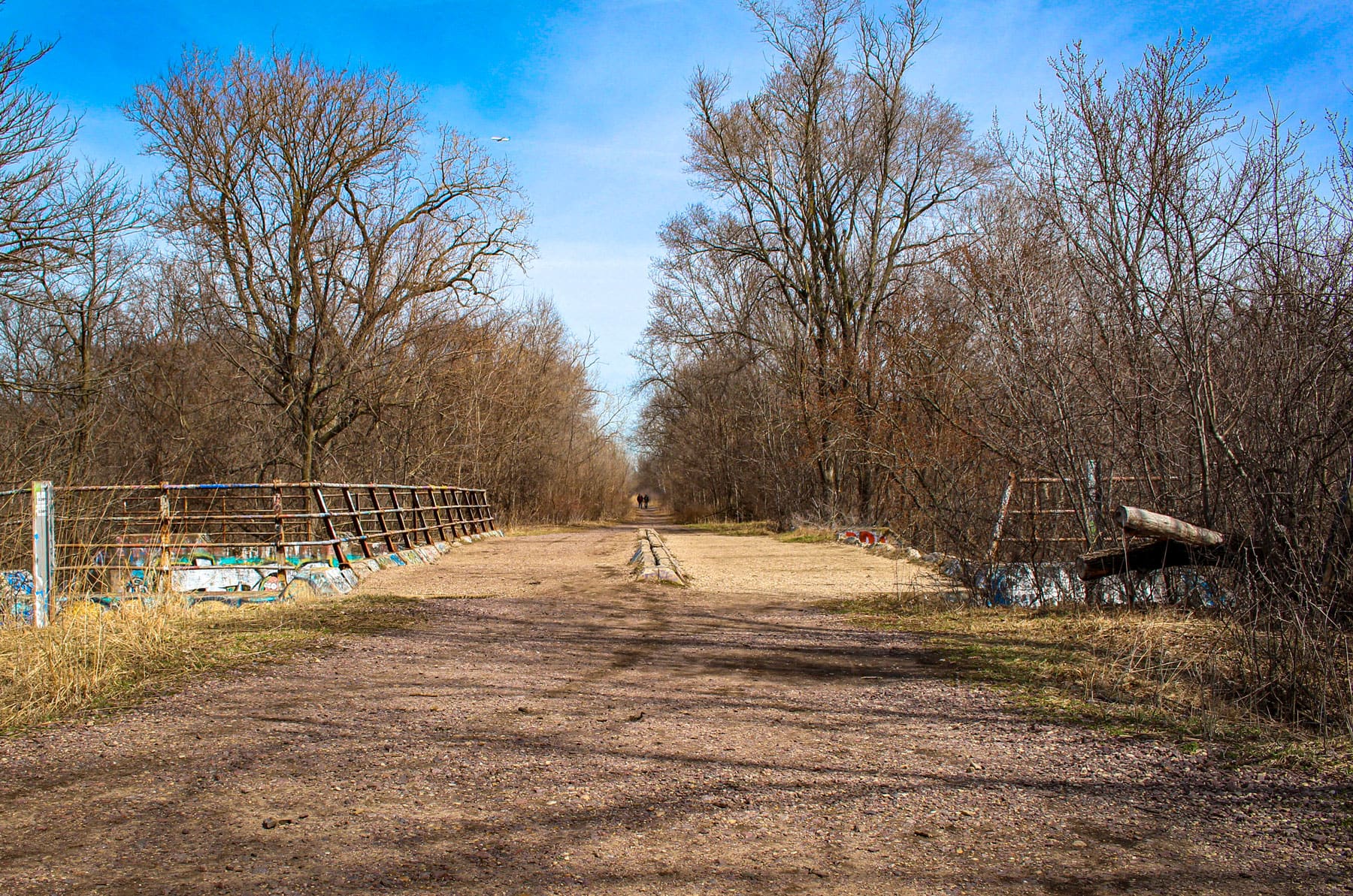
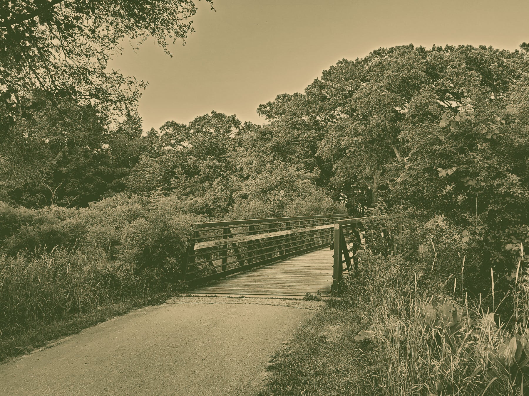
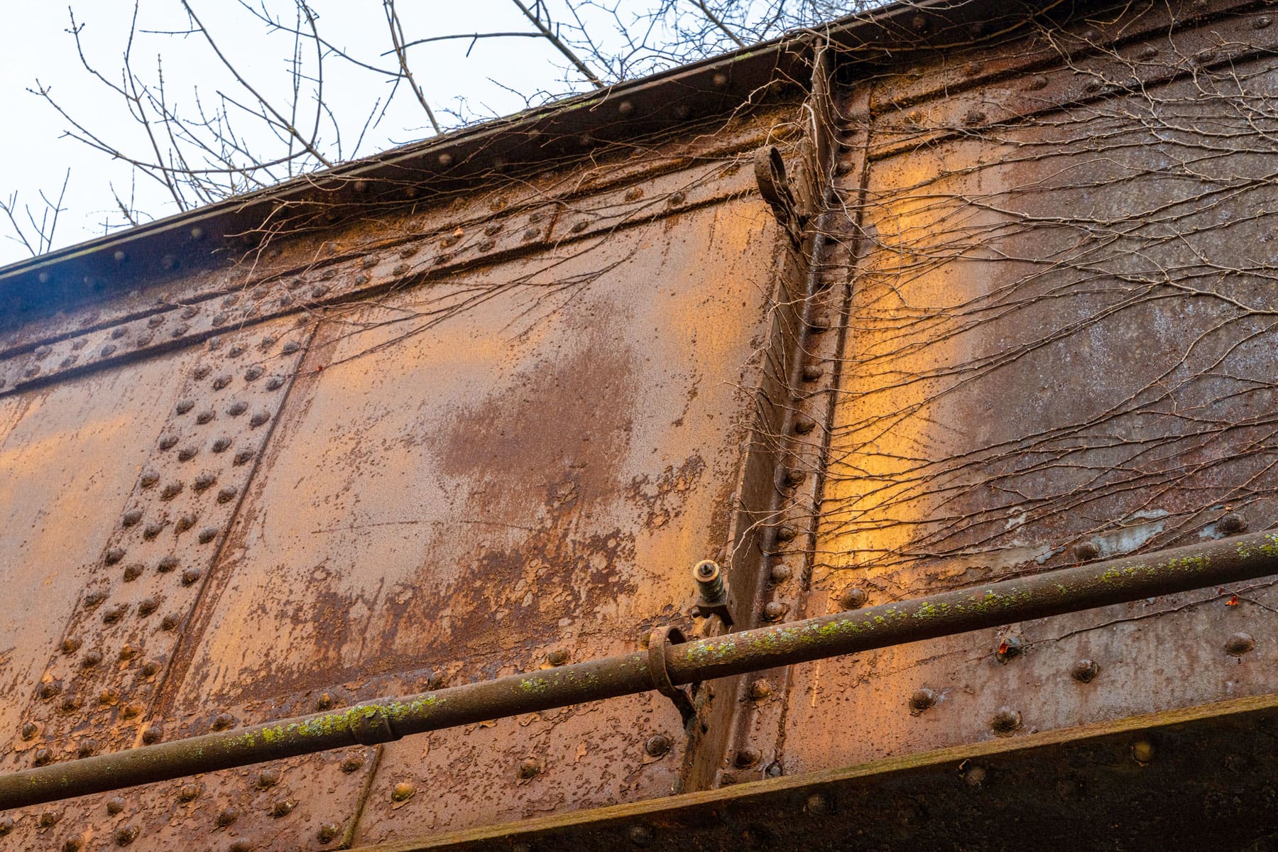
An old bridge near LaBagh Woods, a Cook County Forest Preserve, once carried Chicago and North Western Railway trains. Union Pacific purchased that railroad in 1995, and stopped using the line in 1999.
The bridge and connecting gravel pedestrian trail crosses over the North Branch of the Chicago River. Similar to the effort in Pilsen, there has been a rails-to-trails project called the Weber Spur Trail in the works for a decade, according to Block Club Chicago, as the city seeks to purchase the old Union Pacific right-of-way.
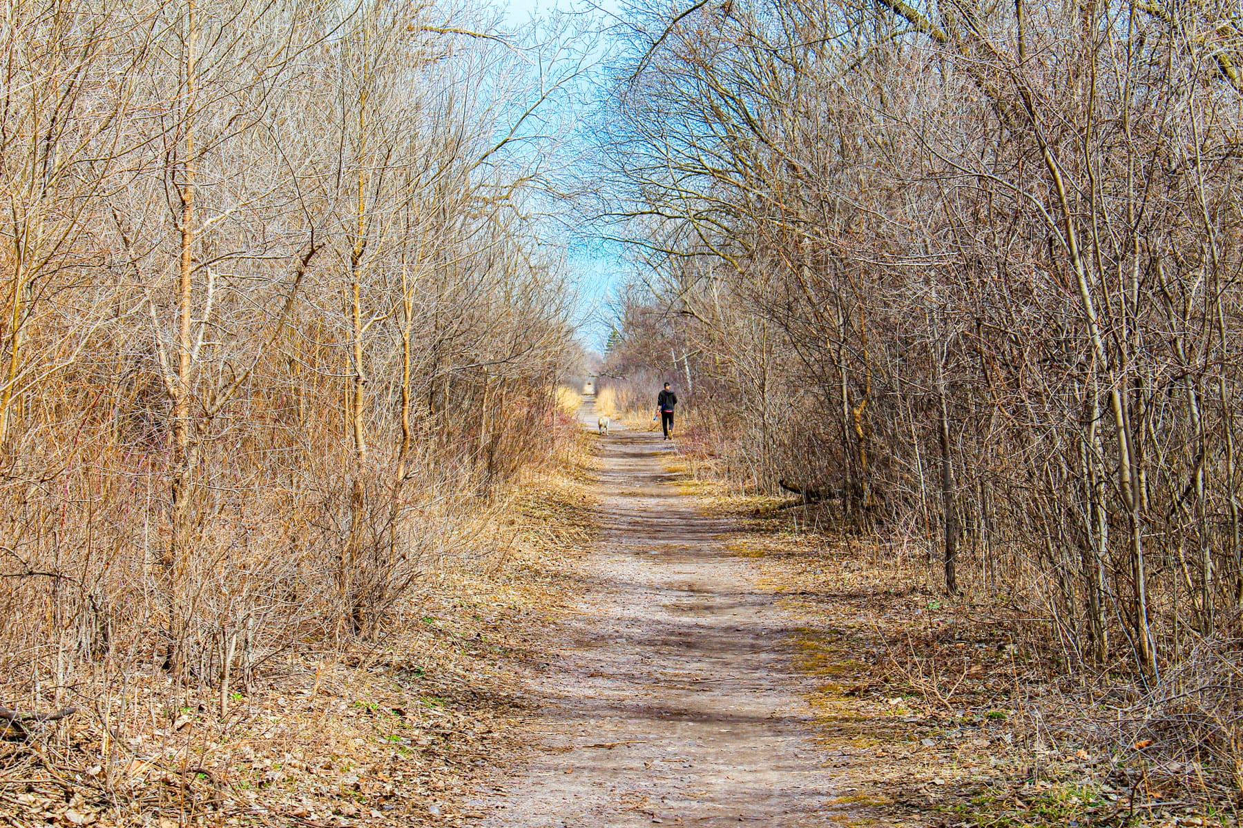
If completed, the Weber Spur trail would stretch 1.7 miles from Elston Avenue to Devon Avenue, and join up with the Union Pacific trail in Lincolnwood.
Related Content