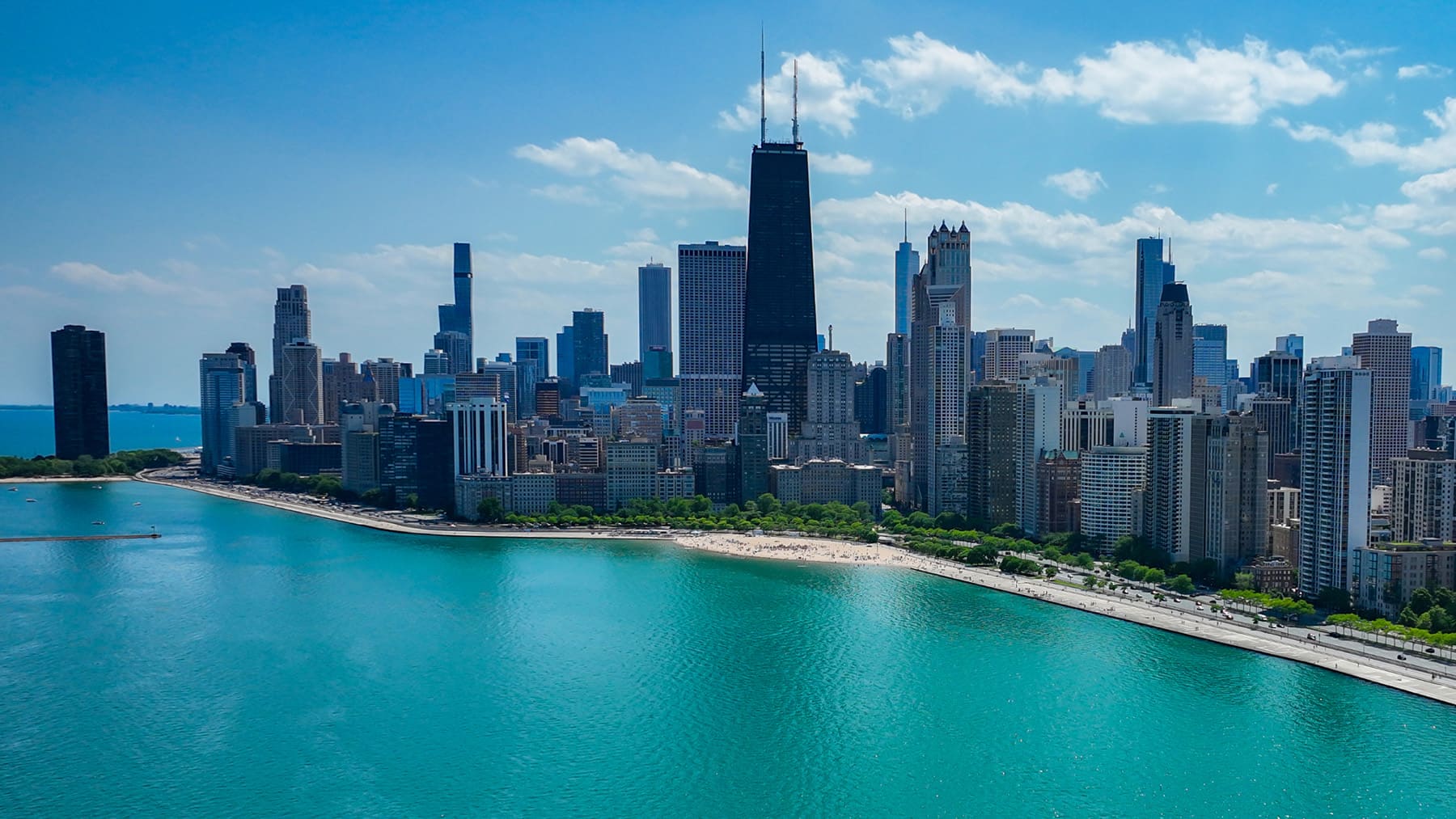
On a warm day with the sun sparkling on Lake Michigan, there’s no better feeling than soaring down Chicago’s Lakefront Trail. The city’s official Lakefront Trail spans 18.5 miles, from the South Shore Cultural Center up to Osterman Beach in Edgewater. There are seemingly endless sights to see and so much to learn about the city from the vantage point of a bike. At various points, you’ll bike next to the water, under the cover of old trees, or in view of architectural gems.
Whether you’re a lifelong Chicagoan wanting to learn more about your city or a new arrival, we’ve picked out 11 notable locations worth learning more about. Each reflects the character and history of the city.
Below, we’ve given you the option to start on the North Side or the South Side. This tour is designed for a one-way trip, so if you’re an experienced cyclist and want to do it all in one day, plan transportation at either end of the trail accordingly. Of course, you can always break it up into sections and do it over a few days. In the warmer months, several public restrooms are available along the trail. We’ve included general directions, but most basic map apps have bike functions.
A few important safety notes: Portions of the Lakefront Trail are divided between bike traffic and pedestrian traffic. Be sure to follow the markings on the pavement or the green signs that indicate the correct path for cyclists. On a nice day, the lakefront can be jam-packed, so slow down in the crowded areas. As always, wear a helmet, bring water, and practice proper bike safety.
Tip: We recommend bringing your bike lock. Some of these stops are best explored on foot.
View tour locations on Google Maps
Choose the direction of travel:
Osterman Beach and Ardmore Avenue
If you’re biking from north to south, the official Lakefront Trail begins near Ardmore Avenue and Osterman Beach in Chicago’s Edgewater neighborhood. This portion of the trail has lots of open greenspace and trees. On your way to the first stop, you’ll pass Foster Beach, athletic fields, and Cricket Hill, where you might see kites flying on warmer, breezier days.
71st street and South Shore Drive
If you’re biking from south to north, the starting point of the Lakefront Trail is at 71st Street and the 7100 block of South Shore Drive, just east of Coles Avenue, and just south of the South Shore Cultural Center.
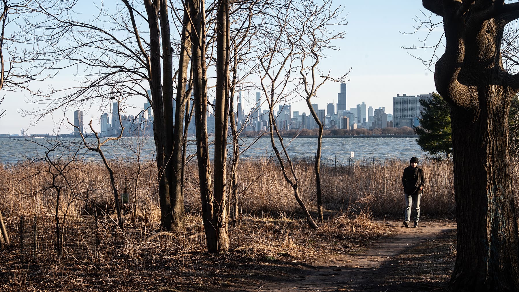
Montrose Point Bird Sanctuary
Approximate distance to this stop: 2.4 miles2.5 miles
How to get there: At Montrose Avenue, take a left and head east toward the lake on Montrose. Our first stop is technically off the Lakefront Trail. As you get closer to the lake, Montrose curves north slightly, and you’ll turn right onto Montrose Harbor Drive. You’ll see a wooded area with a trail surrounded by a short wooden fence. You can’t take your bike into the bird sanctuary, but there are bike racks near some of the entrances to the path and near the beach.
How to get there: Continue north past sprawling Belmont Harbor, the athletic fields, and a golf course. When you reach Montrose Avenue, you’ll depart the Lakefront Trail for a bit. Head east (right) on Montrose Avenue. Follow the road, and as you get closer to the lake, Montrose curves north slightly, and you’ll turn right onto Montrose Harbor Drive. You’ll see a wooded area with a trail surrounded by a short wooden fence. You can’t take your bike into the bird sanctuary, but there are bike racks near some of the entrances to the path and near the beach.
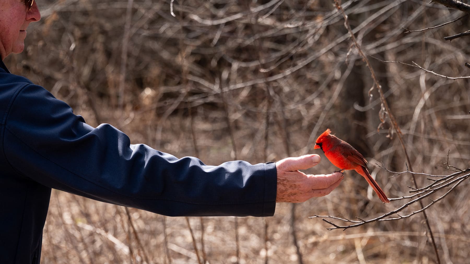
About this stop: Just south of Montrose Beach – and the protected area where the city’s beloved piping plovers spend the summer – sits the Montrose Point Bird Sanctuary, which began taking shape in its current form starting in 2015. In the mid-20th century, Montrose Point was the location of Nike missiles and army barracks. A hedge of honeysuckle obscured the area from public view – with the added bonus of attracting birds. The army site was shut down in the late 1960s, and in the 1980s, the city and local bird organizations began planting more trees and shrubs. According to the park district, some 300 species of birds have been recorded in the area. During the migratory seasons of spring and fall, you might spot some particularly beautiful birds. If you walk toward the edge of the lake, you’ll also get a gorgeous view of the city skyline.
AIDS Garden Chicago
Approximate distance to this stop: 2.6 miles1 mile
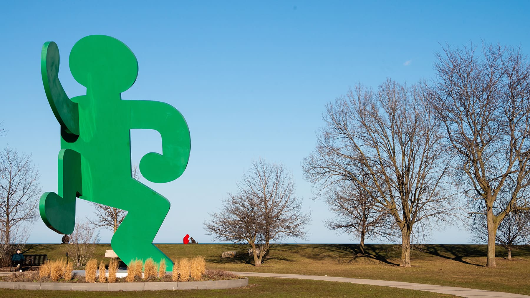
How to get there: Head west on Montrose Avenue to get back on the Lakefront Trail and continue south. You’ll pass a golf course, more athletic fields, and sprawling Belmont Harbor. Just past the southern end of the harbor, on the other side of the parking lot, you’ll spot the 30-foot-tall, green, Keith Haring statue marking AIDS Garden Chicago.
How to get there: Continue north. You’ll pass Diversey Harbor. There’s a marked entrance next to the trail for AIDS Garden Chicago, and if you see the large, green, Keith Haring statue, you’ve made it.
About this stop: AIDS Garden Chicago serves as a public monument to commemorate the HIV/AIDS epidemic in Chicago. The garden – dotted with young ginkgo trees whose leaves turn an electric yellow in the fall – is near the location of the former Belmont Rocks, a popular gathering spot for the LGBTQ community from the 1970s to the 1990s. A section next to the lake was made of large, limestone slabs. People decorated the rocks, sunbathed on them, and had picnics and parties nearby. “It was so important as a place to be ourselves out in the sunshine at a time when our bars still had darkened windows,” author and historian Owen Keehnen said in this Chicago Stories video. At the center of the garden, towering 30 feet into the air, is a Keith Haring sculpture called Self-Portrait. There are also educational plaques with QR codes throughout the garden.
Theater on the Lake
Approximate distance to this stop: 1 mile1 mile
How to get there: Continue south on the Lakefront Trail. You’ll pass Diversey Harbor.
How to get there: Continue north on the trail. Theater on the Lake is located just past Fullerton Avenue.
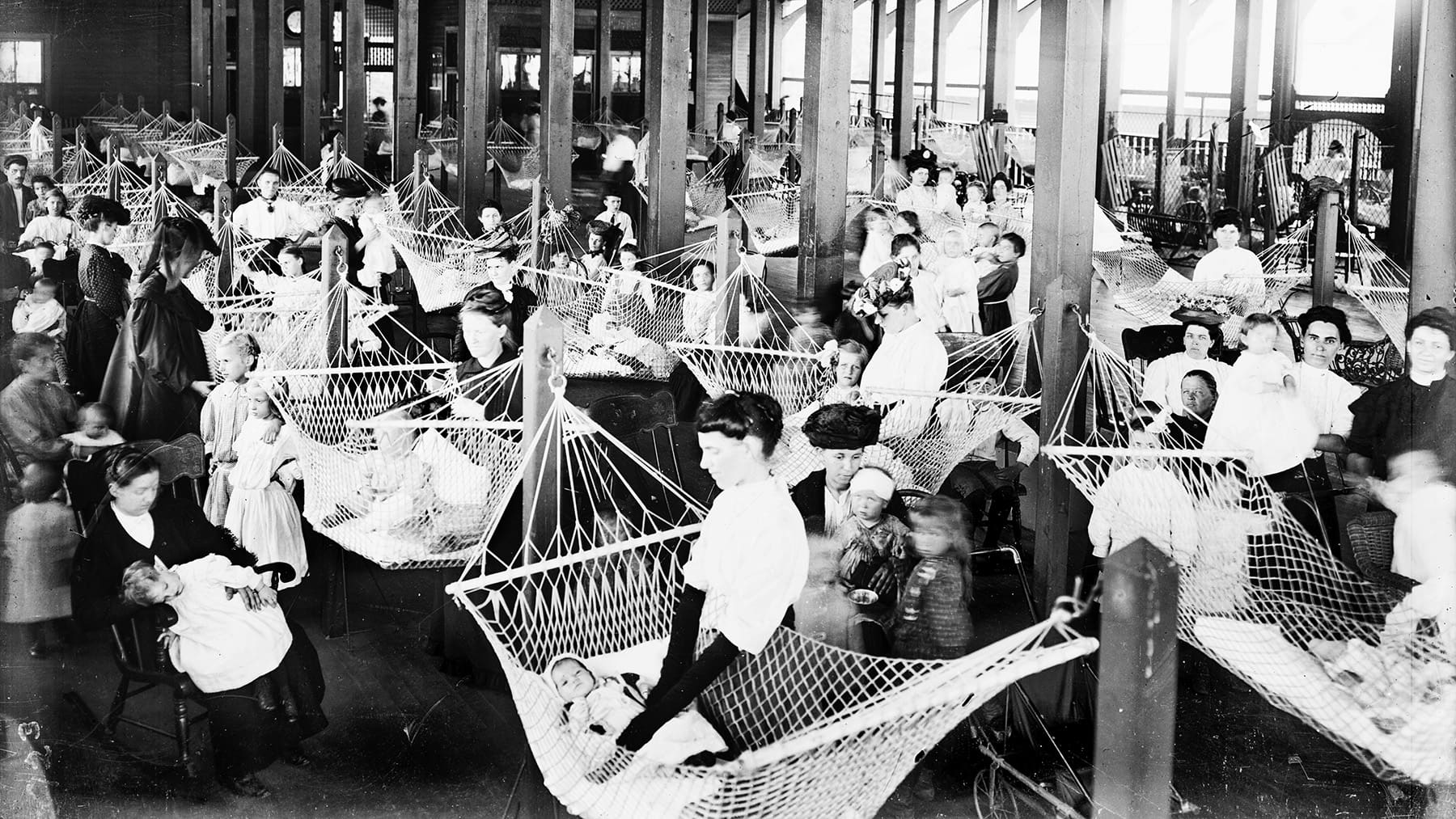
About this stop: Just north of Fullerton Avenue on the lakefront is a renovated, prairie-style building called Theater on the Lake, now a restaurant and event venue, but it has a surprising backstory. Designed by Dwight Perkins (the architect behind Café Brauer at the Lincoln Park Zoo), it was built in 1920 as the Chicago Daily News Fresh Air Fund Sanitarium – an open-air tuberculosis facility for babies. The thinking at the time was that fresh air on the lake would help their condition improve. Some 250 hammocks served as their cribs. On the south side of the building, you’ll find a bronze sculpture of a woman holding two children. The sculpture, called Charitas, is “one of the city’s few twentieth century public monuments produced by a female artist,” according to the park district. That artist was Ida McClelland Stout, a Decatur-born woman who won the 1922 Chicago Daily News contest to design a fountain for the sanitarium. The sculpture originally “stood at the edge of a 30-foot wide circular reflecting basin that also served as a wading pool.” It was put into storage in 1939 and was taken out a couple of times over the years to be displayed in the Lincoln Park Conservatory and the Garfield Park Conservatory. In 2016, it was finally reinstalled near its original location.
North Avenue Beach
Approximate distance to this stop: 1 mile2.5 miles
How to get there: Continue south on the Lakefront Trail. On the other side of DuSable Lake Shore Drive is the Lincoln Park South Lagoon and the Lincoln Park Zoo, which is free to visit if you’d like to make a detour to say hi to the gorillas.
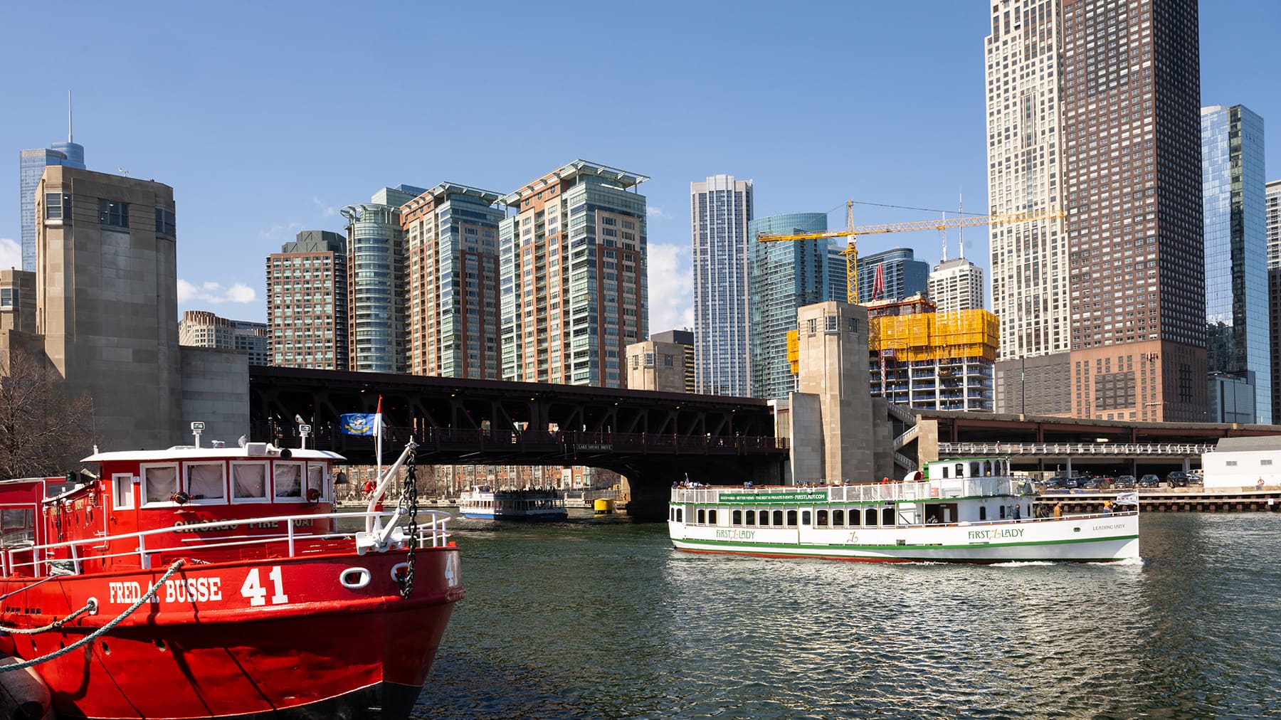
How to get there: Continue on the Lakefront Trail, which will carry you over the Chicago River via the Navy Pier Flyover, which was completed in 2021 and has made it safer for cyclists to cross the bridge over the Chicago River. You’ll pass Navy Pier and Ohio Street Beach, continuing north on a concrete stretch of the trail that runs parallel to DuSable Lake Shore Drive. You’ll pass an area of the lake nicknamed “the Playpen,” where boats gather and tether themselves to one another to create one big party in the summer. The path curves west slightly at Oak Street Beach, and continues north toward North Avenue Beach.
About this stop: North Avenue Beach stretches for several city blocks, and its southernmost end hosts much of the action in the summertime. You’ll find beach volleyball nets, bike rentals, kayak rentals, and a hard-to-miss beach house shaped like an old lake steamship – complete with portholes and an upper deck. North Avenue Pier (which is really just a concrete structure) extends into the water, and the nearby city skyline makes a great backdrop for a photo. Like almost all of the city’s lakefront, North Avenue Beach is man-made. Prior to 1939, this area was just a narrow strip of land. According to the park district, some 875,000 square feet were constructed as part of the Works Progress Administration to create what is now North Avenue Beach. On the other side of DuSable Lake Shore Drive across from North Avenue Beach is Lincoln Park. But it wasn’t always a park. Until approximately 1860, it was a city cemetery, made up of shallow graves that posed a major health risk to the city. Most of the graves were relocated, and now it’s the city’s largest park. As you depart North Avenue Beach, you’ll pass the modernist Chess Pavilion built in 1957 by architect Maurice H. Webster. It was commissioned by the chairman of the Hammond Organ company, Laurens Hammond. The chess boards are built into the structure, but you’ll have to bring your own chess pieces.
The Chicago River
Approximate distance to this stop: 2.5 miles1 mile
How to get there: Continue riding south along the trail. Much of this section runs parallel to DuSable Lake Shore Drive. You’ll pass Oak Street Beach, and then round the curve to a stretch of the trail that’s entirely paved and sits at the water’s edge. As you approach Navy Pier and Ohio Street Beach, you’ll pass an area of the lake nicknamed “the Playpen,” where boats anchor and tether themselves to one another to create one big party in the summer. Closer to Navy Pier, the path ascends a ramp that will carry you along the Navy Pier Flyover, which was completed in 2021 and has made it safer for cyclists to cross the bridge over the Chicago River. On the other side of the river as the path descends another ramp, there’s an open, grassy area where you can stop and walk a little closer to the river. (We don’t recommend stopping on the flyover!)
How to get there: Continue north. There’s an open, grassy area just south of the river where you can stop and walk a little closer to the river.
About this stop: South of Navy Pier, amid the downtown high rises and the noise of DuSable Lake Shore Drive, it’s hard to imagine Chicago as it was in the 18th century – a much more open, natural prairie landscape and an important trading hub for Indigenous tribes that lived in the area long before European settlers arrived. Jean Baptiste Point DuSable is considered by many to be the first non-Indigenous settler and the founder of what would become Chicago. He built his impressive homestead and trading post not too far from here. DuSable lived at the convergence of the Chicago River and Lake Michigan, which back then was closer to present-day Michigan Avenue. (You can read more about DuSable’s life and legacy on the lake here.) Once upon a time, Michigan Avenue was actually ritzy, residential lakefront property. But in the early days of Chicago, erosion posed a serious threat to that property. The city needed a breakwater to protect it, so it allowed the Illinois Central Railroad to build tracks along the lakefront on a trestle approximately 100 yards offshore, and in exchange, the railroad constructed a seawall. Following the Great Chicago Fire, debris and ash were dumped into the lake between the shore and the tracks, creating a makeshift park called Lake Park. But it wasn’t particularly pleasant, with garbage dumps and shantytowns littering the area. Mail-order businessman Aaron Montgomery Ward noticed this from his offices on Michigan Avenue and took it upon himself to file lawsuit upon lawsuit to prevent anyone from building upon the lakefront. His lawyer’s arguments relied on the discovery of a phrase found in a 1836 map of the city that declared that this section of the lakefront should remain “forever open, clear, and free of any buildings or other obstructions whatever.” Ward’s efforts were successful, though he made plenty of enemies in the process. He famously said, “Had I known in 1890 how long it would take to preserve a park for the people against their will, I doubt if I would have undertaken it.” Fast forward to 1909, when architect Daniel Burnham spearheaded the Plan of Chicago, which included a section calling for “the improvement of the lakefront.” Like Ward, Burnham believed the lakefront belonged to the people, writing, “not a foot of its shores should be appropriated to the exclusion of the people.” The city acted on much of Burnham’s plan, transforming much of the lakefront into public parks and expanding the shoreline with landfill from the 1920s to the 1940s.
Buckingham Fountain
Approximate distance to this stop: 1 mile1.25 miles
How to get there: Continue south. You’ll reach a point on the trail where it opens up into a large paved area. The fountain, which is located in Grant Park, will be toward your right as you head south. When it’s on, Buckingham Fountain is hard to miss. You can cross DuSable Lake Shore Drive at the light to get a closer look.
How to get there: Make your way back to the Lakefront Trail, which you can pick up on the eastern side of the Shedd Aquarium. It will curve around the aquarium before heading north. You’ll reach a point on the trail where it opens up into a large paved area. The fountain, which is located in Grant Park, will be toward your left as you head north. When it’s on, Buckingham Fountain is hard to miss. You can cross DuSable Lake Shore Drive at a light to get a closer look.
About this stop: Donated by philanthropist and art patron Kate Buckingham in honor of her late brother Clarence, Buckingham Fountain opened in 1927 and is one of the largest fountains in the world. The fountain, which is made of pink Georgia marble and granite, is modeled on the Latona Fountain in the gardens at Louis XIV’s Palace of Versailles in France – but this one is twice as large and circulates three times the amount of water. When it’s open from May through October, the fountain shoots water up 150 feet. If you arrive at the top of the hour, you may catch one of the water shows, during which some 14,000 gallons of water per minute circulate throughout the fountain.
Northerly Island
Approximate distance to this stop: 1.25 miles4 miles
How to get there: Continue south on the Lakefront Trail – the lake just to your left, Chicago’s iconic skyline to your right, and more of Grant Park – and then you’ll continue through the Museum Campus. The trail winds around the eastern side of the Shedd Aquarium. You’ll have to leave the trail to get to Northerly Island. When you get to Solidarity Drive, go up the ramp toward the road rather than through the tunnel, then go east (left) toward the Adler Planetarium. Take a right down Linn White Drive and keep biking until you pass a small building called the Burnham Park Yacht Club. Just past it, you’ll see a green sign marking the entrance to Northerly Island. (Note: Not all of the paths on the island are paved and may be tougher to navigate on road tires. There are bike racks along Burnham Harbor if you prefer to go on foot.)
How to get there: Continue north on the Lakefront Trail. You’ll be on your bike for a longer stretch this time – about 4 miles. Along the way, you’ll pass Margaret T. Burroughs Beach (also commonly called 31st Street Beach). As you bike along this portion of the lakefront, you’re passing the site of a tragic moment in history. What was then a beach at 29th Street was the site where 17-year-old Eugene Williams was killed in an act of racial violence. It triggered the Red Summer of 1919. Continue toward Oakwood Beach. You’ll also continue past the McCormick Place Bird Sanctuary and sprawling McCormick Place. For this portion of the journey, you’ll depart the trail again. After Soldier Field, there’s a tunnel that will take you under Solidarity Drive (the road north of Burnham Harbor). Go through the tunnel and follow the path that will take you up toward Solidarity Drive, then go east go east toward the lake and Adler Planetarium. Take a right on Linn White Drive and keep biking until you pass a small building called the Burnham Park Yacht Club. Just past it, you’ll see a green sign marking the entrance to Northerly Island. (Note: Not all of the paths on the island are paved and may be tougher to navigate on road tires. There are bike racks along Burnham Harbor if you prefer to go on foot.)
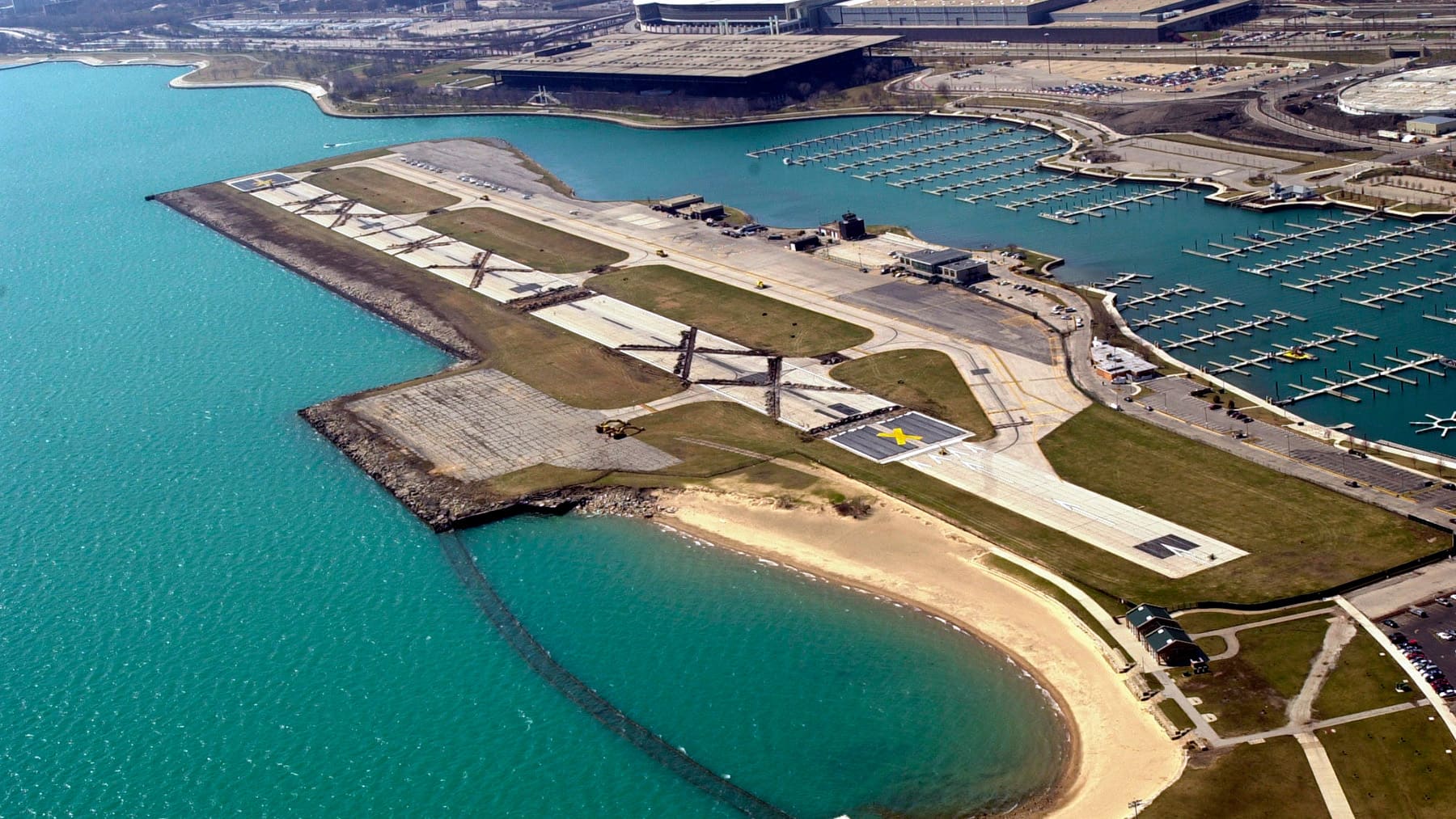
About this stop: In recent years, Northerly Island (which is technically a peninsula) has been transformed into a lush landscape of wildflowers and native plants. It’s still a work in progress, but the juxtaposition between the landscape and the cityscape in the distance is pretty cool. Northerly Island is also the setting for one of the most Chicago-y stories of all time. From 1948 to 2003, a busy airport for small planes called Meigs Field was here. But Mayor Richard M. Daley thought the area would better serve the public as a park, claiming having an airport so close to the city was a security threat in the wake of the 9/11 terrorist attacks. Without informing City Hall, the state government, or the Federal Aviation Administration, Daley sent a brigade of bulldozers to Meigs Field in the middle of the night on March 31, 2003. Under cover of darkness, the bulldozers carved six X’s into the runway, rendering it unusable. Despite the unsurprising blowback Daley received, the end result may be closer to that which architect Daniel Burnham envisioned all along. In his Plan of Chicago, Burnham called for a string of man-made islands extending south from here to preserve the lakefront for the public and create more green space. Northerly Island was the only one that was ever built.
The Mermaid Sculpture
Approximate distance to this stop: 4 miles2 miles
How to get there: After leaving Northerly Island, make your way back to the Lakefront Trail, which you can pick up on the other side of Burnham Harbor. You’ll be on your bike for a longer stretch this time – about 4 miles. Along the way, you’ll pass Soldier Field, sprawling McCormick Place, the McCormick Place Bird Sanctuary, and Margaret T. Burroughs Beach (also commonly called 31st Street Beach). As you bike along this portion of the lakefront, you’re passing the site of a tragic moment in history. What was then a beach at 29th Street was the site where 17-year-old Eugene Williams was killed in an act of racial violence. It triggered the Red Summer of 1919. Continue toward Oakwood Beach.
How to get there: Continue north along the Lakefront Trail. Along the way, you’ll pass 49th Street Beach. If it’s a clear day and the water is calm, you might catch a glimpse of the shipwreck of the Silver Spray. After the blue 43rd Street Pedestrian Bridge, take the path just past the basketball courts until you reach a grassy, rocky patch just south of Oakwood Beach.
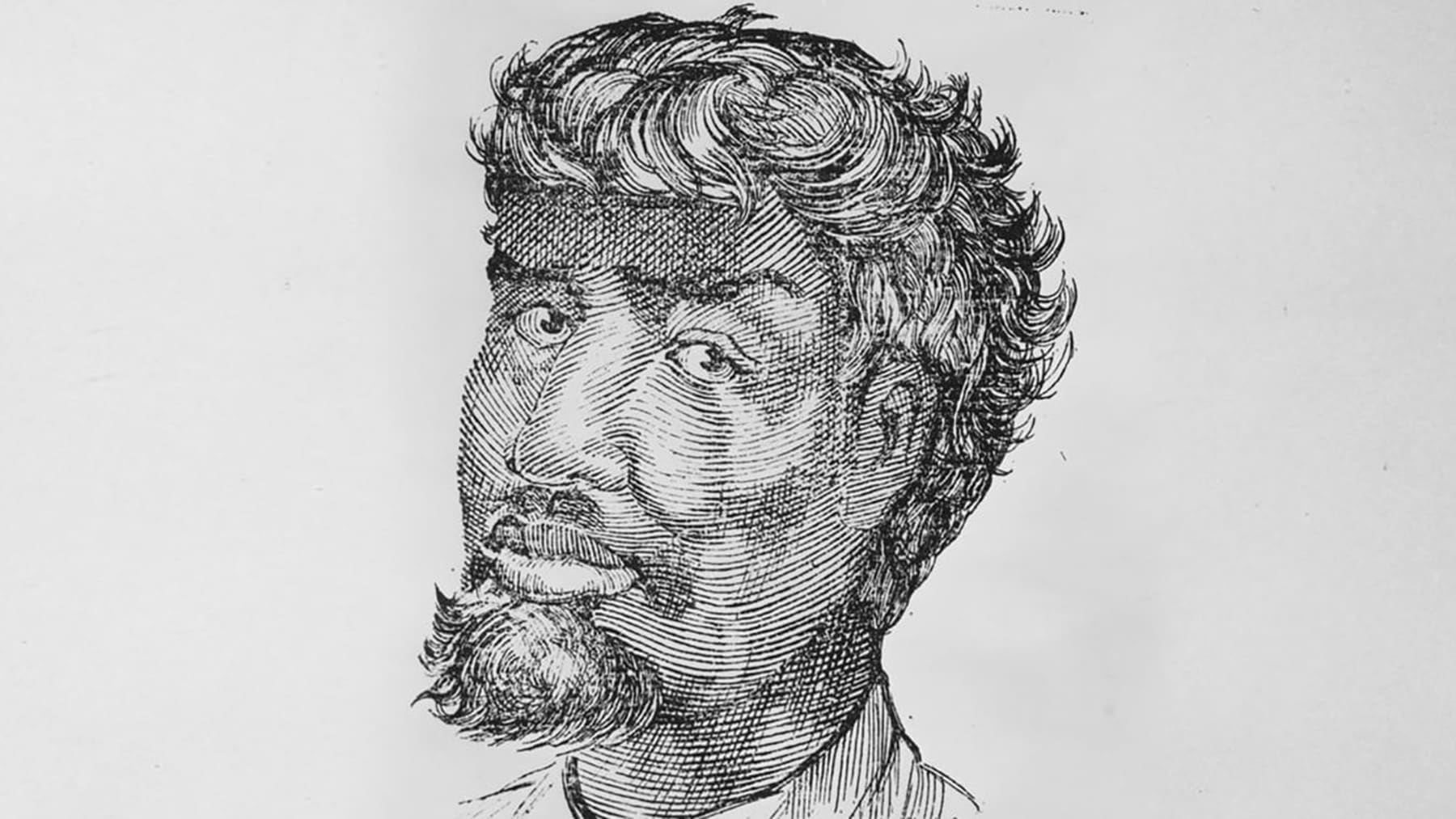
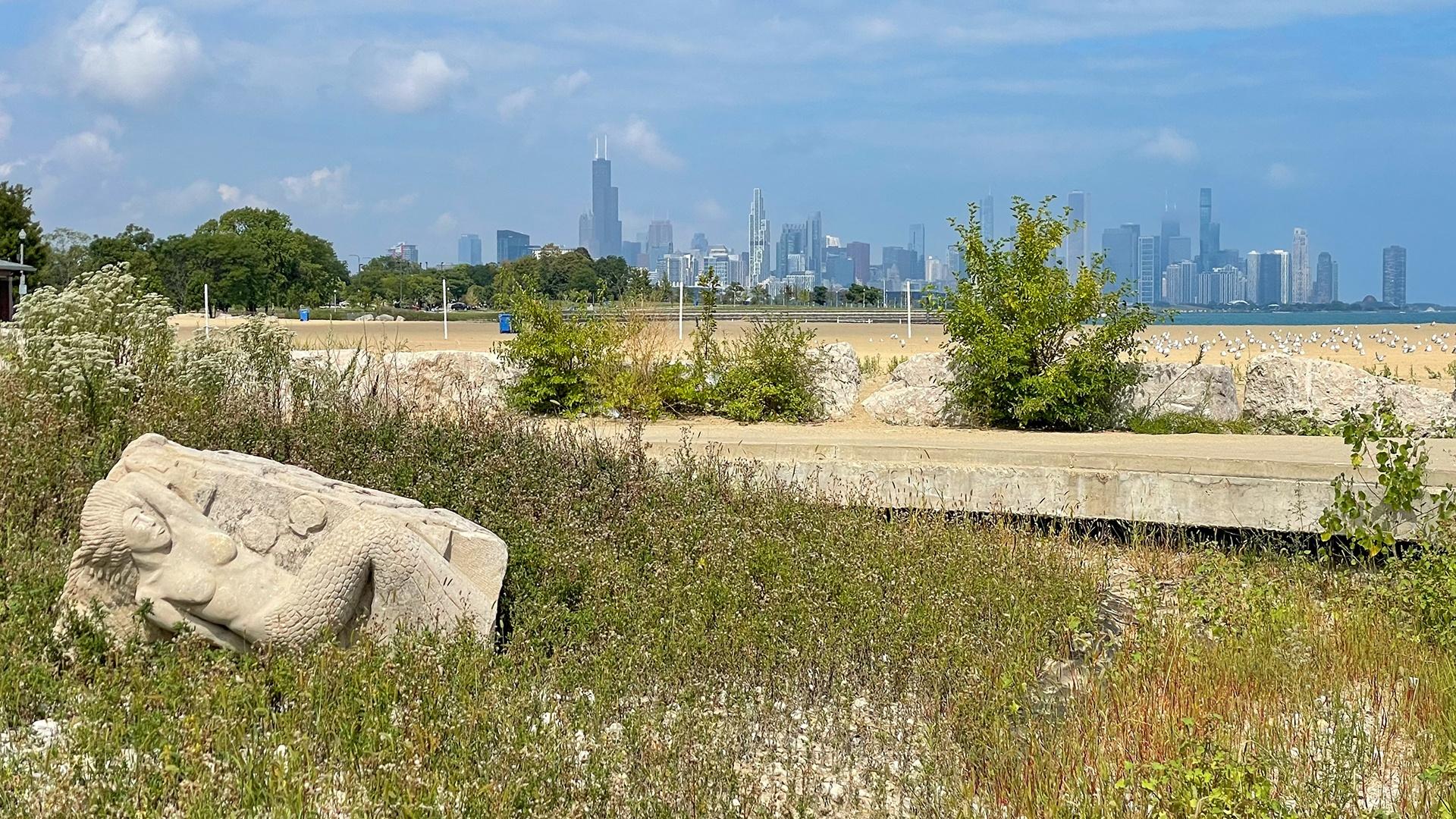
About this stop: Reclining in an encircled, grassy, rocky patch just south of Oakwood Beach in Burnham Park is a curious sculpture that had a mysterious origin. Over the course of 10 days in 1986, artist Roman Villarreal and a few of his friends carved a mermaid into one of the limestone blocks called revetments that protect the lakefront. They didn’t have permission from the city or park district, but no one seemed concerned enough to stop them, including a police officer who asked them what they were doing. For years, the origins of the mermaid was a mystery, as the artists never revealed themselves. But Villarreal’s daughter, who had served as the model for the mermaid, told the Chicago Sun-Times the real story in 2000. In 2004, the mermaid was moved into storage, and after a three-year stay in Bessemer Park in the South Chicago neighborhood, it was placed at its current location in 2010.
Promontory Point
Approximate distance to this stop: 2 miles1.5 miles
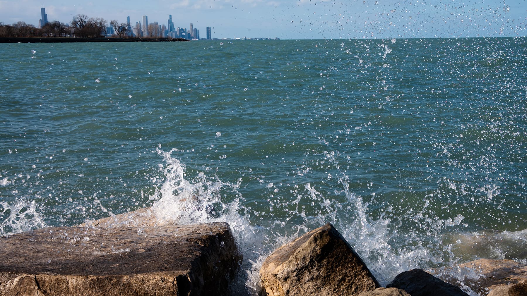
How to get there: Continue south on the Lakefront Trail. Along the way, you’ll pass 49th Street, where just off the shore on a clear, calm day, you might catch a glimpse of the shipwreck of the Silver Spray. As you bike south, you’ll see the shoreline curve out toward the lake at Promontory Point. The portion of the trail on the peninsula is the pedestrian path, so if you’d like to explore the point toward the edge of the lake, hop off your bike and walk it for others’ safety.
How to get there: To get back on the Lakefront Trail, you can depart Wooded Island the way you entered, on the southern end of the island over the small bridge. Bike east toward the lake and past the athletic fields. Head north (left) after the driving range. Bike north, and just after 59th Street Harbor, the park path curves down and around into an underpass. This will take you back under DuSable Lake Shore Drive, where you can pick up the Lakefront Trail again. Continue north past 57th Street Beach. The trail will curve outward at Promontory Point. The portion of the trail on the peninsula is the pedestrian path, so if you’d like to explore the point out toward the edge of the lake, hop off your bike and walk it for others’ safety.
About this stop: Promontory Point, a 40-acre, man-made peninsula between 54rd and 56th streets, is another lakefront treasure. Originally conceived by Burnham in his 1909 Plan of Chicago, it took years for his vision to be realized. It was completed in 1938, and Alfred Caldwell was the landscape architect for the project. As with the Montrose Point Bird Sanctuary, Promontory Point has a military connection. In the 1950s, it was the site of radar towers serving as the control center for a nearby Nike missile base. The system was decommissioned in the 1970s. Today, Promontory Point is often used for weddings, and its limestone revetments, which step down to the water’s edge, provide lake access that make it a popular spot for water sports. Chicago’s shoreline once had some 9 miles of limestone revetments installed as part of the Works Progress Administration. The limestone revetments at Promontory Point are the last surviving remnant of that project, and they have been a point of contention for years. In 2000, city officials and the Army Corps of Engineers announced a plan to replace the limestone with concrete, saying the limestone had been damaged by the water over the years. A group of Hyde Park residents formed a group to prevent the demolition of the revetments and are still in a protracted fight to prevent their removal.
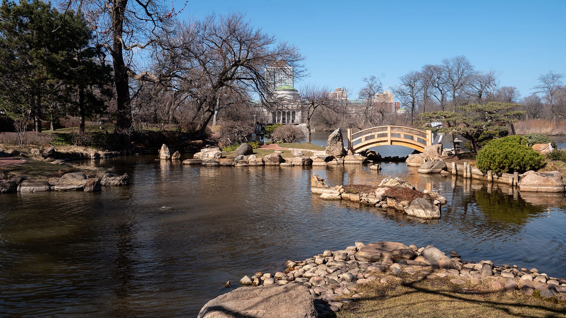
Jackson Park’s Wooded Island and Garden of the Phoenix
Approximate distance to this stop: 1.5 miles2.4 miles
How to get there: Continue south. Our next leg of the journey will take us off the Lakefront Trail and into Jackson Park, which is on the other side of DuSable Lake Shore Drive. To get to Wooded Island, you’ll need to go through an underpass when you reach 59th Street Harbor, approximately 0.8 miles from Promontory Point. Continue on the path south of the harbor, past the tennis courts, dog park, and driving range. Right after the driving range, turn right (west) toward the lagoons. Between the east and west lagoons, you’ll see a small bridge to access Wooded Island. The Garden of the Phoenix is located on the north end of the island. A note: Bikes are not allowed in the Garden of the Phoenix, so keep an eye out for a bike rack and be prepared to explore on foot.
How to get there: Follow the Lakefront Trail north; the first stretch runs parallel to South Shore Drive. The path will curve inward as you pass between Jackson Park’s inner and outer harbor. Just past Hayes Drive and the 63rd Street Beach House, you’ll need to briefly depart the trail to go through the underpass that will take you into Jackson Park. On the other side of DuSable Lake Shore Drive, you’ll pass a parking lot. As you approach the athletic fields, you’ll want to bike north (right) toward the Jackson Park lagoons. Between the east and west lagoons, you’ll see a small bridge to access Wooded Island. The Garden of the Phoenix is located on the north end of the island. A note: Bikes are not allowed in the Garden of the Phoenix, so keep an eye out for a bike rack and be prepared to explore on foot.
About this stop: The beautiful Jackson Park was the site of the 1893 World’s Columbian Exposition, although the park itself predates the fair. Some 20 years before the fair, landscape architects Frederick Law Olmsted and Calvert Vaux were hired to design the park at a time when the city’s population was booming and people were looking for more greenspace as a break from the crowded city. Olmsted and Vaux looked to their surroundings – the swampy lakefront – for inspiration, creating a network of lagoons. Jackson Park is part of a larger vision of Olmsted and Vaux to create a network of two large South Side parks, Jackson Park and Washington Park, connected by the Midway Plaisance. Olmsted returned to reconfigure Jackson Park to serve as the location of the fair at the invitation of the fair’s design director Daniel Burnham. The Garden of the Phoenix was home to the pavilion for the Japanese government during the fair. The garden was rehabbed multiple times over the years, and today, it is the site of a lovely spectacle each spring: the blooming of the cherry blossoms. Just outside the Garden of the Phoenix is a shining steel sculpture called Skylanding, created by Yoko Ono. Elsewhere in Jackson Park you’ll find one of two structures that remain from the fair. It’s the Palace of Fine Arts, which is today the Museum of Science and Industry, situated at the north end of the park. (The other is the Art Institute of Chicago on Michigan Avenue.) Now visible from Jackson Park is the site of the Obama Presidential Center, slated to open in spring 2026.
South Shore Cultural Center
Approximate distance to this stop: 2.4 miles0.2 miles
How to get there: Make your way back to the Lakefront Trail. If you leave Wooded Island on the southern end, head east toward the lakefront, passing Jackson Park’s athletic fields. Bike south toward Hayes Drive. Just north of Hayes Drive within the park is another underpass to access the Lakefront Trail. The trail will dip back west as it passes between Jackson Park’s inner and outer harbor, then it continues back towards the lake and south alongside South South Shore Drive to the South Shore Cultural Center. The gate to the South Shore Cultural Center is at the corner of South Shore Drive and 71st Street. (The southern trailhead of the Lakefront Trail is at 71st Street.)
How to get there: You don’t have to travel far for the first stop! The Lakefront Trail begins just south of the South Shore Cultural Center, and you can enter the grounds at 71st Street and South Shore Drive, across from the Metra train tracks.
About this stop: Originally designed to be an opulent and exclusive country club on Lake Michigan, the South Shore Cultural Center is now part of the Chicago Park District. Architect Benjamin Marshall (who also designed the Drake Hotel, Edgewater Beach Hotel, and the ill-fated Iroquois Theater) designed the South Shore Country Club when Lawrence Heyworth, president of the Chicago Athletic Club, wanted space in a “country” setting. The club’s original building was built in 1905, but the club outgrew it, according to the Chicago Park District. In 1916, the present lakefront building (once again designed by Marshall) was constructed in the Mediterranean Revival style. Even as the demographics of the South Shore neighborhood shifted, becoming a Jewish community and then a mostly Black community, the club excluded Jewish people and Black people from membership. The club closed in the 1970s and was ultimately purchased and restored by the city’s park district. It was also the location of future-President Barack Obama and Michelle Obama’s wedding reception. Today, the property includes a park, golf course, and beach, and the building houses various programs for the arts, including music, dance, visual arts, ornate event spaces, and even a rodeo.
71st street and South Shore Drive
The Lakefront Trail ends just south of the South Shore Cultural Center at 71st Street and the 7100 block of South Shore Drive, just east of Coles Avenue.
Osterman Beach and Ardmore Avenue
If you pick up the Lakefront Trail again at Montrose Avenue, it continues north another 2 miles. This portion of the trail has lots of open greenspace and trees. You’ll pass Cricket Hill near Montrose Avenue, where you might see kites flying on warmer, breezier days. You’ll pass more athletic fields, and Foster Beach. The trail concludes at Ardmore Avenue and Osterman Beach in Chicago’s Edgewater neighborhood.